Description of the DalCoast-HFX System
The hindcast and short-term forecasts of sea levels, currents, temperatures, and salinity are produced by a multi-nested coastal ocean modelling system known as DalCoast-HFX, which features five submodels covering different geographic regions and horizontal resolutions. External forcing used to drive DalCoast-HFX consist of atmospheric forcing (wind, pressure, surface heat flux), tides, freshwater runoff from major rivers in the region, and large-scale oceanic circulation taken from the ocean circulation model for the northwest Atlantic Ocean. The figure below demonstrates model domains from the outermost (L1) to the innermost (L5) submodels. The black dashed square in each panel indicates the next submodel level domain:
Fig. Domains and major bathymetric features of the five submodels of the multi-nested ocean prediction system.
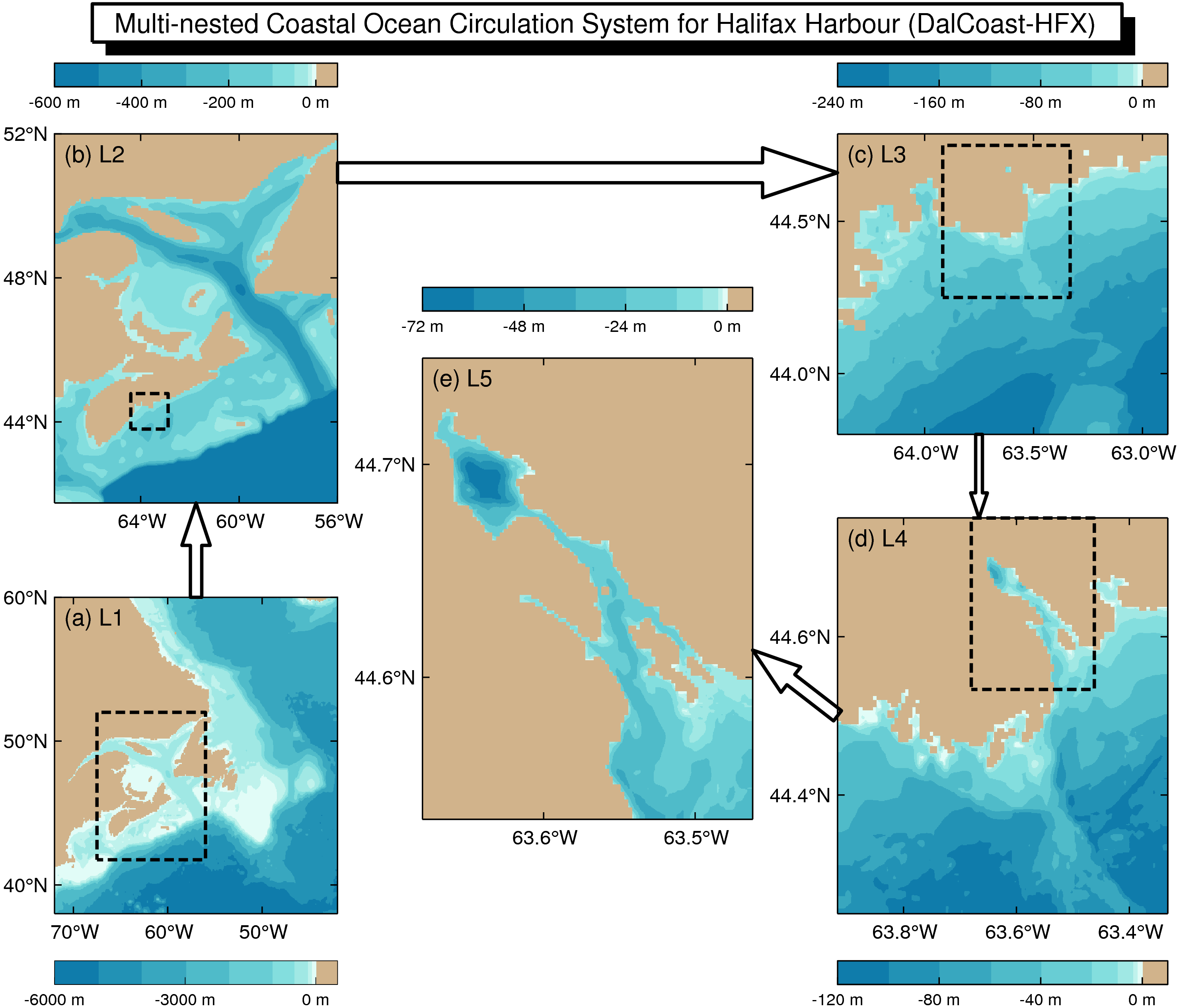
The outermost submodels, L1 and L2, are based on DalCoast and constructed from the Princeton Ocean Model (POM). Submodels L3 to L5 are based on the free-surface version of CANDIE, which is a 3D, primitive equation ocean circulation model that uses an A-grid and a fourth-order advection scheme.
Submodel L1 is a 2D and barotropic storm surge model covering the eastern Canadian shelf from the Labrador Shelf to the Gulf of Maine with a horizontal resolution of 1/12°. Submodels L2 to L5 are 3D and baroclinic with horizontal resolutions of 1/16°, ~2 km, ~500 m and ~200 m, respectively. Submodel L2 covers the Gulf of St.Lawrence and the Scotian Shelf using 30 σ-level in the vertical. Submodels L3 to L5 use 32 unevenly spaced z-levels. The domain of submodel L5 covers Halifax Harbour and Bedford Basin, and uses a newly generated gridded topography of Halifax Harbour with a horizontal resolution of ~200 m.